A “locality” is a geographic location within a state or territory. It is will be one of several census-defined location types:
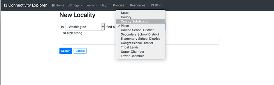
- State: A US State or Territory.
- County: County within a State.
- County Subdivision: A subdivision within a County, such as a Township.
- Place: A Census-defined Place.
- Unified School District: A recognized unified school district.
- Secondary School District: A recognized secondary school district. This type is inactivated if the State does not have any Secondary school districts.
- Elementary School District: A recognized elementary school district. This type is inactivated if the State does not have any Elementary school districts.
- Congressional District: A district in the US Congress.
- Tribal Lands: Census-recognized tribal areas, including both Reservations and Off-Reservation Trust Lands.
- Upper Chamber: The State Legislative Upper chambers (e.g. State Senates), or the only chambers in unicameral States.
- Lower Chamber: The State Legislative lower chambers (e.g. State Houses) in bicameral State.
Tips
![]() When you are creating a Locality, the search box tries to match all of the Localities in the state with the search text anywhere in their names. So if you enter “Port” in as a place in Oregon, you’ll be asked to choose among Newport, Port Orford, Portland, Reedsport, Waldport, or Westport.
When you are creating a Locality, the search box tries to match all of the Localities in the state with the search text anywhere in their names. So if you enter “Port” in as a place in Oregon, you’ll be asked to choose among Newport, Port Orford, Portland, Reedsport, Waldport, or Westport.
![]() Leaving the box blank brings up all of the localities (of that type) of in the state.
Leaving the box blank brings up all of the localities (of that type) of in the state.
![]() When a single locality is found, it gets added to the notebook. When the search turns up multiple localities, you’ll be asked to choose among them.
When a single locality is found, it gets added to the notebook. When the search turns up multiple localities, you’ll be asked to choose among them.
When should I put multiple Localities in a Notebook? discusses the pros and cons of notebook management, including using multiple localities in a single notebook.